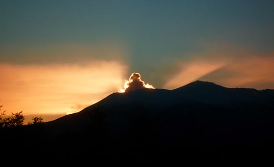
- Section 1 The Tongariro Alpine Crossing: an overview
- Section 2 Is the Tongariro Crossing for you ?
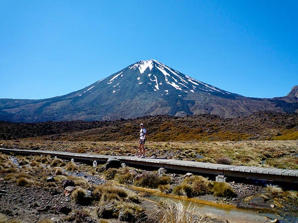
- Section 3 Tongariro Crossing track description
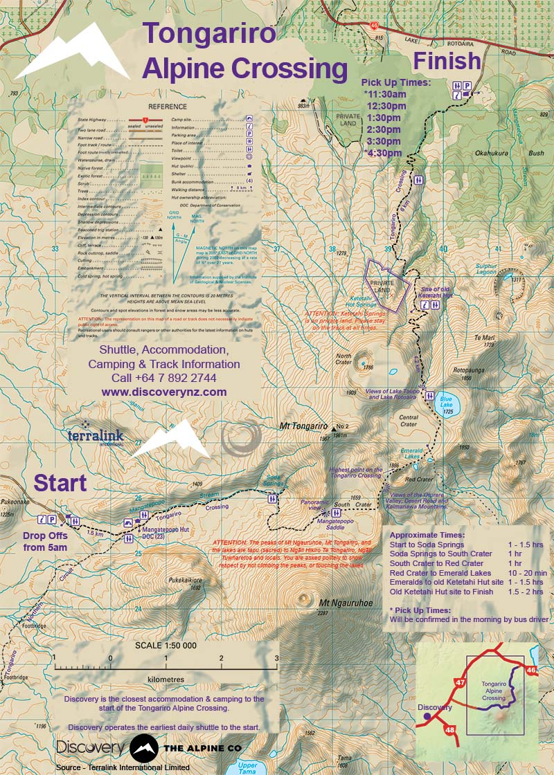
- Section 4 Tongariro Crossing Map
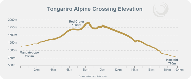
- Section 5 Tongariro Crossing Elevations
- Section 6 Planning your Tongariro Crossing adventure: what you need to know
- Section 7 Hazards, risks & problems
- Section 8 Tongariro Crossing weather: what you need to know
- Section 9 Tongariro Crossing shuttles
- Section 10 Villages & towns near the Tongariro Crossing
- Section 11 Tongariro Crossing accommodation: close to the start
- Section 12 Tongariro Crossing camping: close to the start
- Section 13 Tongariro Crossing seasons
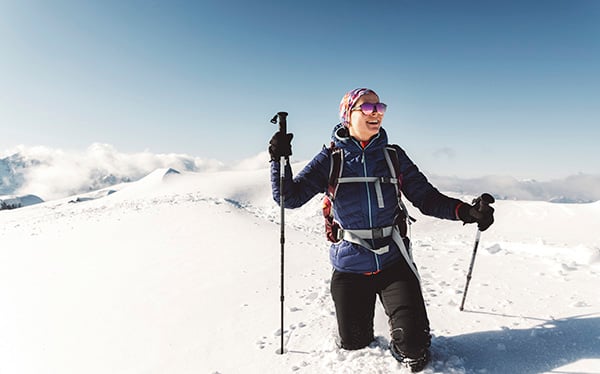
- Section 14 Tongariro Crossing winter experience
- Section 15 When's the best time to start the hike
- Section 16 Tongariro Crossing hiking gear
- Section 17 Food & Water
- Section 18 Tongariro Crossing alternatives
Mangatepopo to Soda Springs
The Tongariro Crossing starts at the Mangatepopo Road end at 1120m above sea level.
From the start the track weaves up the Mangatepopo Valley to the Soda Springs.
This section of track climbs 260m over 4.5km, so an easy gradual rise to start with.
The track is well maintained with sections of board walk along the way.
Soda Springs to South Crater
This section is the first of two big climbs on the Crossing.
From Soda Springs the track heads to the top of the Mangatepopo Saddle. This climb is often referred to as the Devil's Staircase.
It should be renamed Stairway to Heaven, as there're almost enough steps to reach heaven.
The views from the top are out of this world.
This section is 1.6km and ascends 280m. This gives an average gradient of 18% or 10 degrees.
On average it takes between 45 minutes and 60 minutes to complete the Mangatepopo Saddle (Devil's Staircase) climb.
The track underfoot is constructed to a high standard and is mostly stepped.
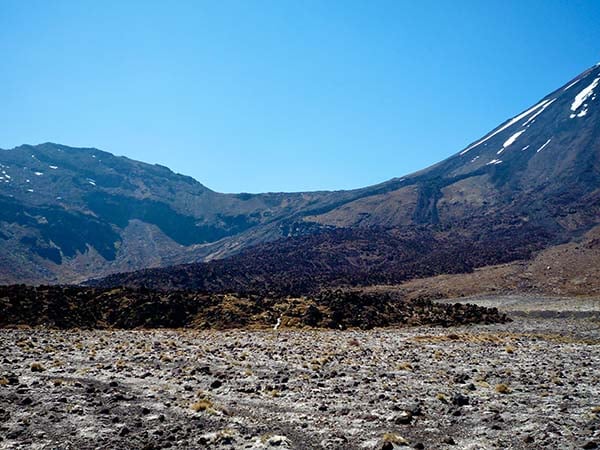
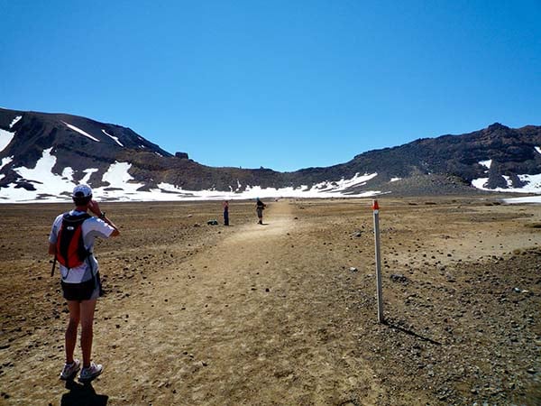
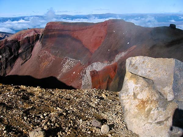
South Crater
The South Crater spans from the top of the Mangatepopo Saddle (Devil's Staircase) to the start of the Red Crater climb.
The South Crater is 1km across. It's flat and a welcome relief from the first climb.
South Crater to the top of Red Crater
This section is the second and last big climb on the Crossing.
The Red Crater climb is 1km and ascends 188m. This gives it an average gradient of 19% or 11 degrees.
On average it takes between 45 minutes and 60 minutes to complete.
The middle section of the Red Crater climb is steep with slippery loose gravel in places.
This section is 305m and ascends 105m which gives an average gradient of 34% or 19 degrees. Your heart and lungs will be pumping here.
The top of the Red Crater ridge is the highpoint of the Tongariro Crossing at 1868m above sea level.
At this point the terrain falls away steeply on either side of the track.
Although the peak is 15m wide it can feel relatively narrow in strong winds.
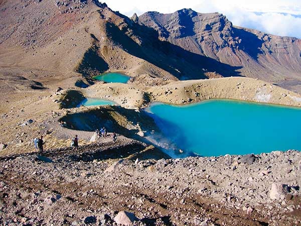
Red Crater to Emerald Lakes
From the Red Crater peak the tracks drops 123m over 330m to the Emerald Lakes. Which is an average gradient of 37% or 20 degrees.
This part of the track is loose scree. Many hikers prefer to use a stick or poles to help themselves down this section.
Coming down from the Red Crater can be fun, if you can let yourself go with the flow.
But don't be surprised if you end up on your bum at least once.
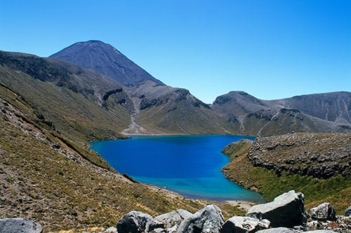
The Emerald Lakes are stunning. This is a great place to stop for a rest if the weather is fine.
Note, the Emerald Lakes and the Blue Lake are Tāpu (sacred) to Ngāti Tūwharetoa and they politely ask you respect this by not touching them.
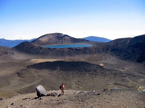
Central Crater
From here the track travels 1km across the flat Central Crater and up a small rise to the Blue Lake.
Another nice place for a rest, and maybe some lunch.
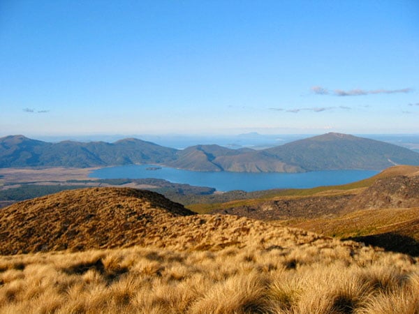
Blue Lake to Ketetahi finish
Once you reach the Blue Lake all the climbing is finished. It's a little too soon to celebrate though.
Many people find the long 9km down hill hard work. It can be testing on the quadriceps and knees.
The spectacular views across Lake Rotoira, Lake Taupo, and surrounding peaks do help.
PRO TIP: the sign at the site of the old Ketetahi Hut says 1.5 hours to the finish. This section normally takes 2 hours for most people.
If you're looking for a detailed track description and the geology of the Tongariro Crossing you'll find it here.
Here's a topographical map of the Tongariro Alpine Crossing.
Click on the Download PDF button below for highest quality printing.
Please note, this map is produced for Discovery Lodge. The drop off times and pick up times are particular Discovery.
Tongariro Crossing elevations, ascent and descent.
All heights are above mean sea level (AMSL).
| Metres | Feet | |
| Mangatepopo start | 1120 m | 3675 ft |
| Top of Red Crater (highest point on the track) | 1868 m | 6129 ft |
| Ketetahi finish | 760 m | 2493 ft |
| Total ascent | 748 m | 2454 ft |
| Total descent | 1108 m | 3636 ft |
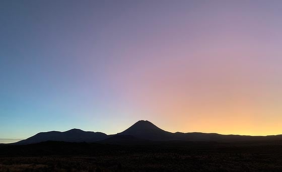
Summer hiking months
The most popular months to hike the Tongariro Crossing are from November through to April.
During these warmer months the track is clear of snow and ice.
See below for more on enjoying the Crossing during winter.
Winter alpine hiking months
Snow and ice covers the Tongariro Crossing during July to September. Depending on the winter, snow and ice can still cover the track in October.
You will need alpine experience to hike the Crossing during these snowy months.
If you don't have experience you can hike the Crossing with a guide. This can be an exhilarating experience.
See more below.
Shoulder months
It's possible to enjoy the Crossing during the shoulder months of October, May and June. But only if the track is clear of snow and ice.
These months are quiet compared to the summer months. So a good time to hike the Crossing if you prefer to hike in solitude.
Every winter season is different. Some years the Crossing has snow on the track as late as early November. Other years the snow is gone by early October.
Some years the winter snow arrives late making it possible to hike the Crossing during May and June.
A word of warning: The weather for May and June can be changeable and difficult to predict.
You'll need to prepare for winter weather.
It's a bad idea to hike the Crossing during these months if you don't have the best quality alpine hiking gear.
It can be a challenge to find a shuttle for drop off and pick up during these quiet months. Many shuttle companies don't operate during these months.
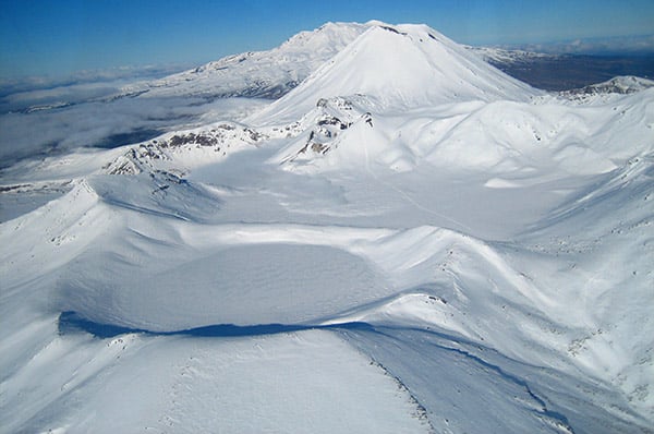
The picture above was taken on the 19th October 2018. The Red Crater ridge was clear of snow and ice. The Emerald Lakes and the Blue Lake were still frozen.
The big difference between a summer Crossing and a winter Crossing is snow.
Snow and ice cover the landscape during July to September and part of October.
For these months white snow blankets many of the geological features including the South Crater, Red Crater, Emerald Lakes, Central Crater and the Blue Lake.
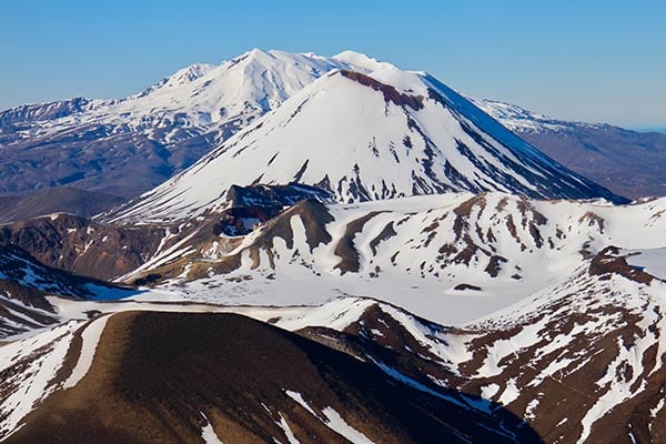
On a fine day a winter Tongariro Crossing journey can be spectacular. You'll marvel at wide ranging views of the volcanoes and the surrounding land forms.
Alpine experience is necessary to traverse the track in winter. You'll need ice axe and crampons.
No alpine experience, or gear? No worries.
Go with a guiding company. You do need a good level of fitness as hiking over snow can be tiring.
You don't need any snow, ice, crampon or ice axe experience what so ever. The guiding company will provide the gear and coach you along your journey.
Here's two local guiding companies to contact:
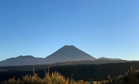
During the summer months the Crossing is clear of snow. All the volcanic features are in full view.
PRO TIP: Compare cancellation policies before you book.
Tongariro Crossing weather can be unpredictable. The weather can change from sunshine to rain and cold in minutes.
For this reason it's critical you pack gear for all weather.
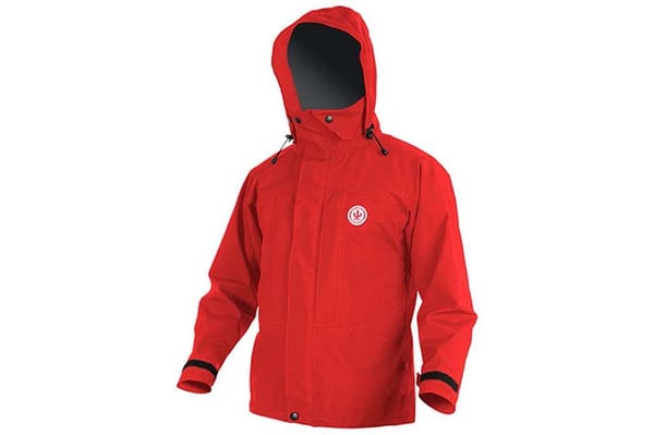
Here's a list of essential gear to hike the Tongariro Alpine Crossing:
- Good quality water proof jacket
- Plenty of warm layers
- Warm hat
- Sturdy footwear
- Food and water
- Sun protection
- Map
It's good to take a mobile phone as well.
More detailed information about essential gear needed to hike the Tongariro Crossing can be found here.
Tama Lakes

Compare Tongariro Crossing shuttles: for your epic adventure
One way Tongariro Crossing shuttle v's return shuttle